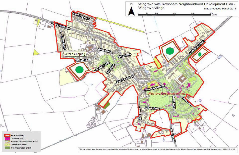
Local Green Spaces – Wingrave Village
Wingrave & Rowsham Neighbourhood PlanLocal Green Spaces as defined in Paragraph 77 of the NPPF
The Local Green Spaces will not be appropriate for most green areas or open spaces. The designation should only be used, where the green space is in reasonably close proximity to the community it serves, where the green area is demonstrably special to a local community and holds a particular local significance, for example because of its beauty, historic significance, recreational value (including as a playing field), tranquillity or richness of its wildlife and where the green area concerned is local in character and is not an extensive tract of land.
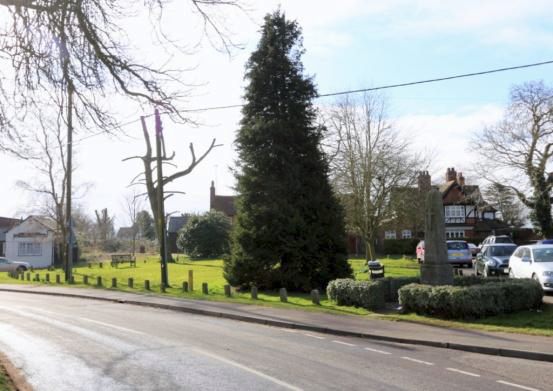
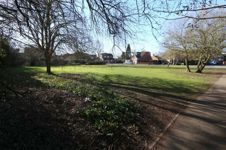
The Village Green
The Village Green is at the historic centre of the old village. The Parish War Memorial is located here and this is where November 11th Remembrance festivals are held. The area is historically significant for the village as an open space used for social congregation and is already a protected area. This Green Space is 891 sq metres and is in character with the local area
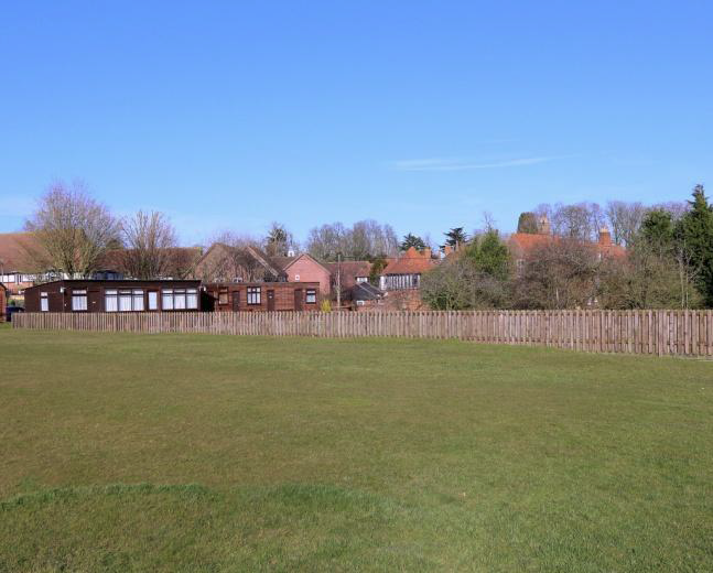
The Recreation Ground
The Recreation Ground is bounded on the north by Church Street, on the west mostly by the 19th Century Rothschild Cottages, the south by Moat Lane which has a number of Rothschild Cottages. On the eastern side of the Recreation Ground it is bounded by Moat Lane. The Recreation Ground is used for many sports events, including Football matches, Bowls and Croquet. The area already has protected status and is historically significant to the village as it is part of the Rothschild legacy from the 19th Century. The Recreation Ground is 18,224 sq metres and is clearly in character with the surrounding 19th Century Rothschild Cottages
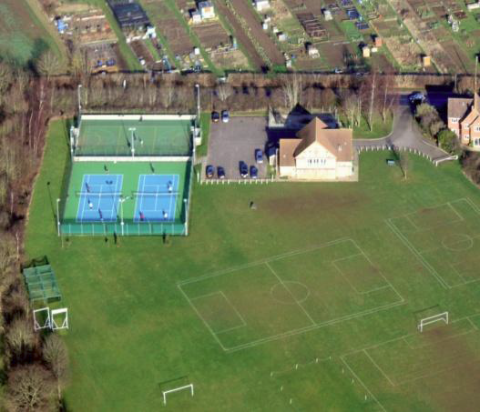
Wingrave Park, Sports Ground and Pavilion
Wingrave is particularly fortunate to have an extensive Sports Ground and Pavilion located adjacent to the Winslow Road, near to the northern entrance to the village towards Wingrave Cross Roads. The Sports Ground is on a long term lease from Pratts Charity and is used extensively for recreation purposes. Football and Cricket Matches are played here and the site is used for the Village Fete. Wingrave Park is 35,331 sq metres and is in character with the adjacent Chiltern Rd and bounding agricultural land
Twelve Leys Green
The Twelve Leys area of the Village is mostly a 1970s development. It has a small green area near the village School and is an important recreational area for the children of that part of the village. Twelve Leys has a housing density of 25 dwellings per hectare with large and often extended homes with consequently small gardens and it is important that there is a small recreational space where children can play whilst under the eyes of parents. This green space is already protected. The Twelve Leys Green is 1,489 sq metres and is in the character of the adjoining properties.
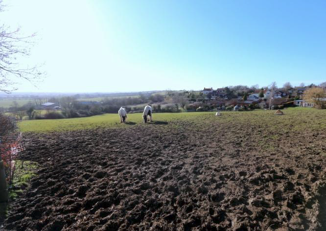
The Knolls – Church Street
The Knolls is a south west facing steeply sloping field on the northwest side of Church Street just past Coblers Wick. The field is used to graze a number of ponies but it has considerable recreational and amenity value to the village. For over thirty years it has been the location of the village bonfire and firework display to celebrate November 5th. In winter it has been used for more than living memory as the village tobogganing and sledging field as it has the most appropriate slope for such activities in the village. The field has spectacular far reaching panoramic views over the Vale of Aylesbury to the Chilterns and on towards Chinnor. For all these reasons the field has considerable green space and amenity to the village. The Knolls is 1.4 hectares and is in character with the adjacent Church Street and the bounding agricultural land.
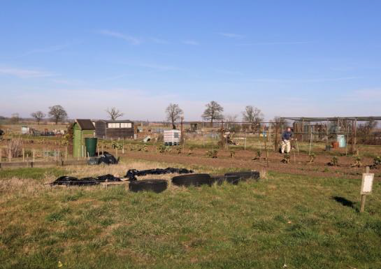
The Village Allotments
Wingrave is fortunate to have Village Allotments. These Allotments are enjoyed by many residents and there is a waiting list to acquire an Allotment. The Parish Council considered that the Green Space of the Allotments is preserved as a Village amenity. The Allotments are 15,435 sq metres and are in character with the local landscape.
Other small green spaces
There are number of small Green Spaces distributed around Wingrave that are too small for housing development. It is important that these spaces are protected from encroachment and development or in any way misused. All these Green Spaces are recognised as local amenity space and are in character with their location. This includes the:
- Green space on Winslow Road near Ravens Walk (876 sq metres).
- Green space on Abbotts Way (1,330 sq metres).
- Pond on Parsonage Farm. Site of protected species including Great Crested Newts.
This Neighbourhood Plan will result in development in the village and the Parish Council wishes that the developments include their own new Green or Amenity spaces. This is required to preserve the rural nature of the village, to protect where appropriate, adjacent listed buildings and conservation areas and to provide amenity space for the residents of the new dwellings.
The location of the new Green Spaces are shown on the map indicated by a green circle.